This page provides a variety of maps detailing the Purple Line alignment.
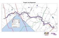
Alignment Map
This is a map of the Purple Line project area showing all 21 stations.
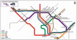
Purple Line Alignment Map
Download 1.86 MB
Transit Map
A simplified map showing the Purple Line and its connections to other regional transit systems.
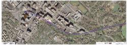
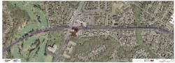
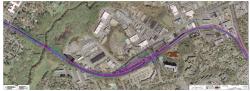
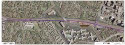
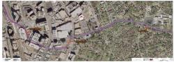
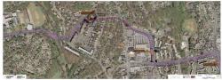
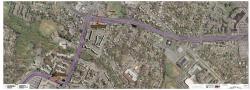
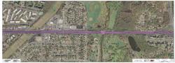
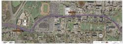
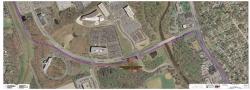
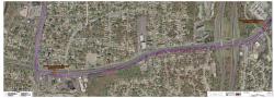
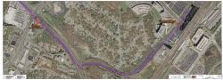
Purple Line Transit Map
Download 443.05 KB
Aerial Maps
These give an aerial view of the Purple Line alignment. Zoom in to get an up-close look at the proposed Purple Line in your neighborhood.
Bethesda to Columbia Country Club
Download 7.16 MB
Columbia Country Club to Jones Mill Road
Download 4.16 MB
Jones Mill Road to CSX Corridor
Download 14.58 MB
CSX Corridor to Silver Spring Transit Center
Download 3.98 MB
Silver Spring Transit Center to Dale Drive
Download 7.53 MB
Mansfield Road to University Boulevard
Download 15.88 MB
University Boulevard – Arliss Street to Lebanon Street
Download 6.94 MB
University Boulevard – Lebanon Street Guilford Road
Download 4.38 MB
University Boulevard – Guilford Road to Adelphi Road
Download 5.28 MB
University Boulevard – Adelphi Road to UMD
Download 7.33 MB
UMD to College Park Metro
Download 4.07 MB
River Road to Kenilworth Avenue
Download 10.86 MB
Kenilworth Avenue to Riverdale Road
Download 11.77 MB
Riverdale Road to Veterans Parkway
Download 15.54 MB
Veterans Parkway to Ellin Road
Download 3.49 MB